Little Bear Blanca Traverse, Ellingwood Point
The tackling the first of the so called Great Fourtneer Traverses in Colorado.
 The infamous hourglass climb which was quite chill and less loose than purported for me to kick any rocks down.
Thankfully I did manage to get above another group just before this section that did cause a ton of rockfall.
I think sticking to the more vertical sections than in the gully proper probably minimizes the hazard.
Also don’t know why people put fixed ropes here that are kind of sketchy to use 🤷♂️.
The infamous hourglass climb which was quite chill and less loose than purported for me to kick any rocks down.
Thankfully I did manage to get above another group just before this section that did cause a ton of rockfall.
I think sticking to the more vertical sections than in the gully proper probably minimizes the hazard.
Also don’t know why people put fixed ropes here that are kind of sketchy to use 🤷♂️.
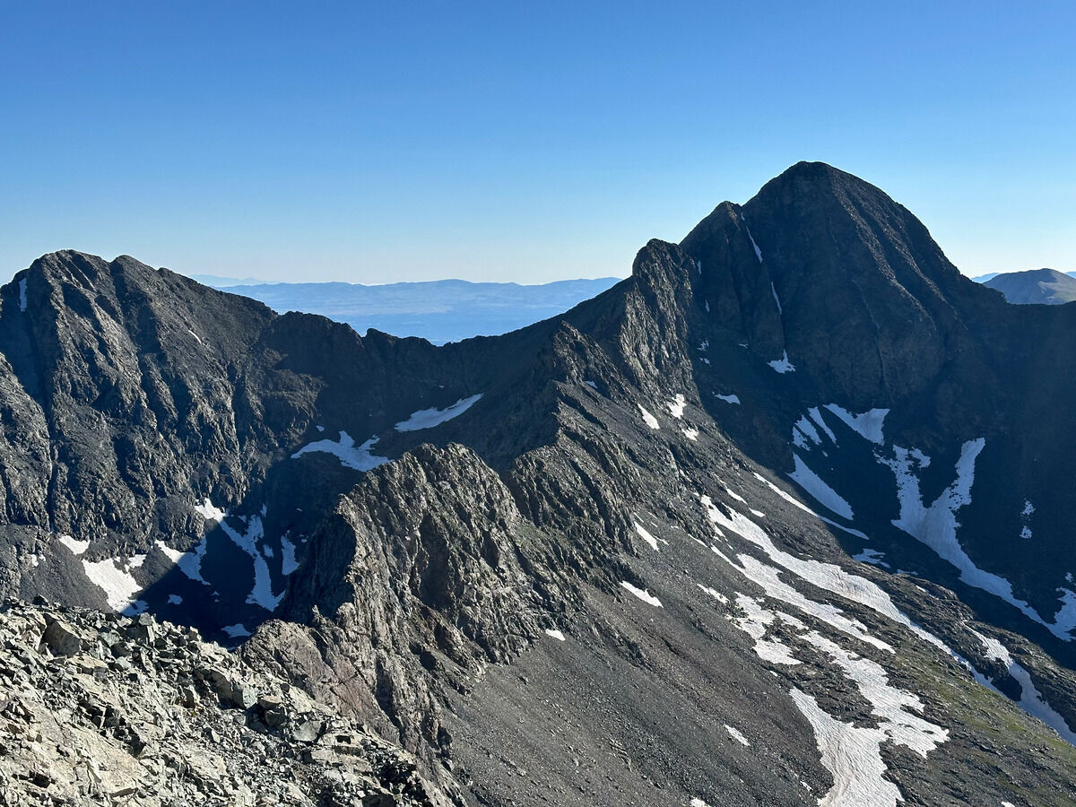 The ridge to Blanca Peak
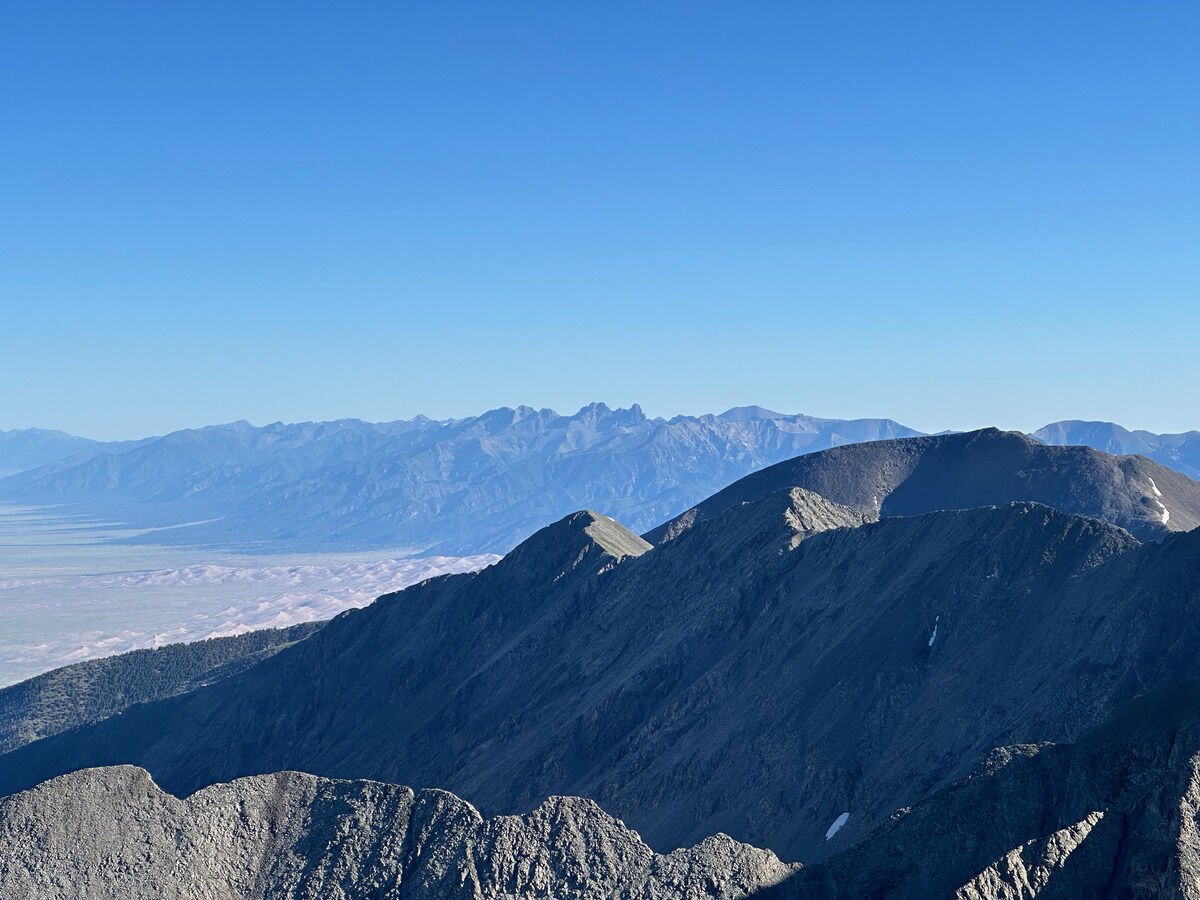 Crestone group in the distance with the sand dunes slightly obscured
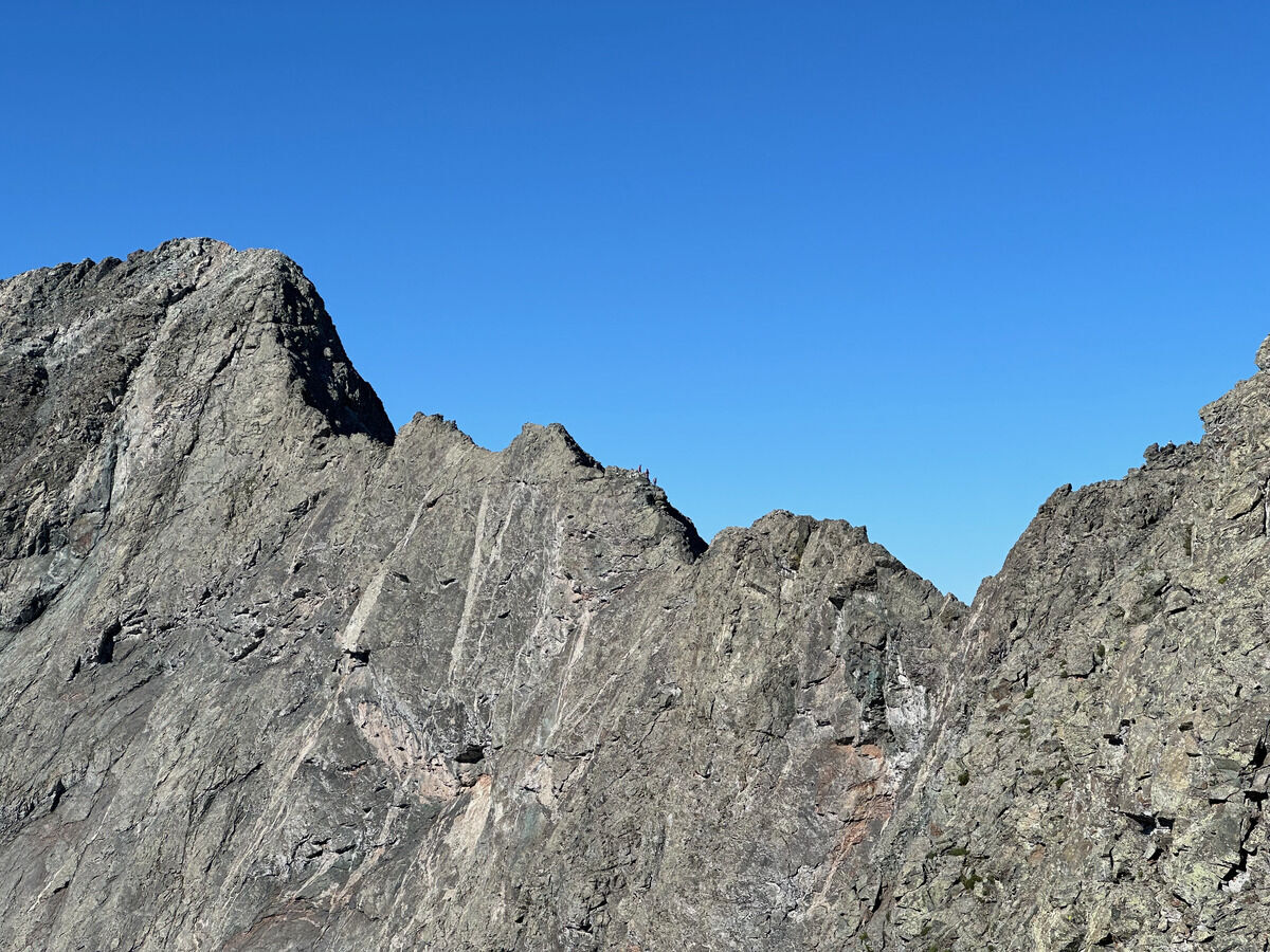 Tiny ants on the ridge
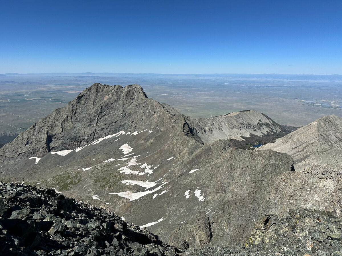 Looking back on the full ridge to Little Bear Peak
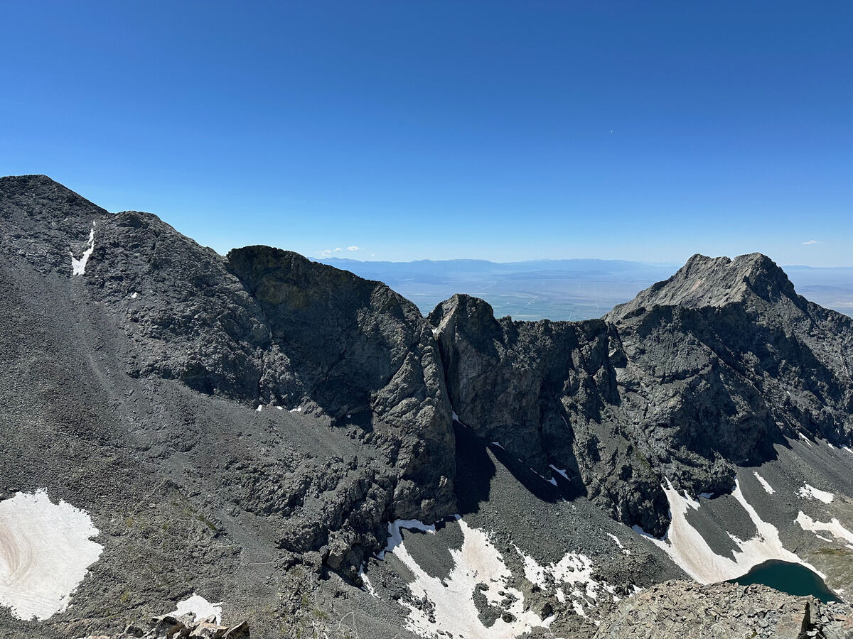 Another angle from Ellingwood Point
 Going down it was ABSOLUTELY
 UN-
UN-
 FREAKING
 RUNNABLE
Notes
- This was probably ~17 miles and ~7800 feet of vertical gain in 10 ½ hours. I think I started around around 8300 feet, a few hundred feet below where most AWD vehicles make it up because...
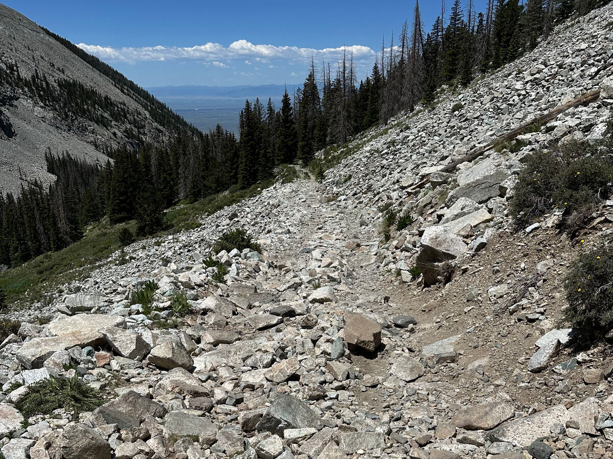
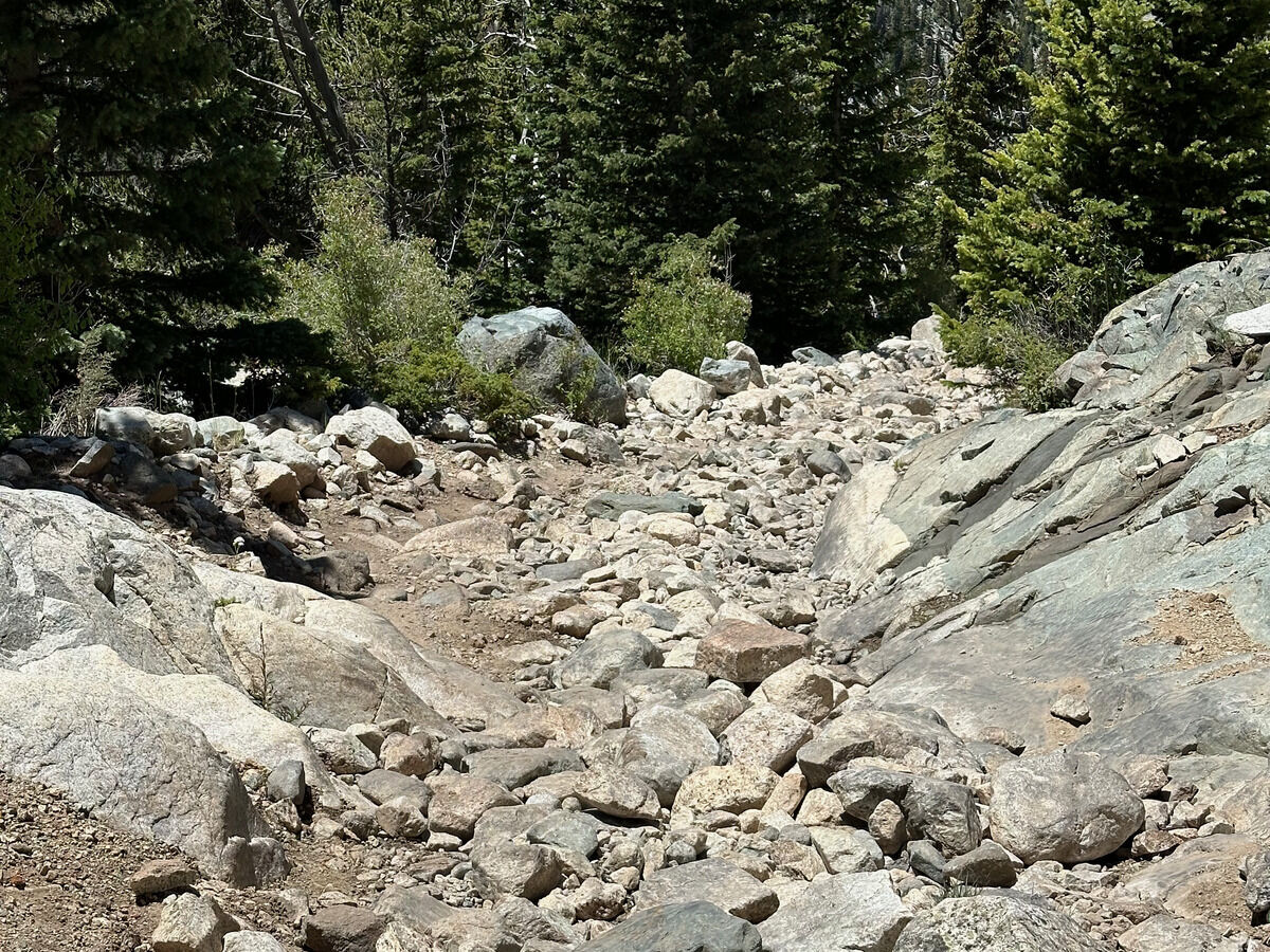
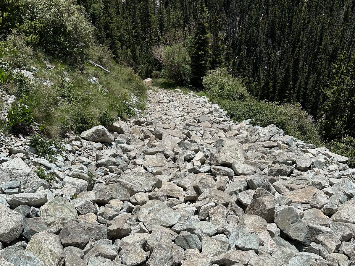
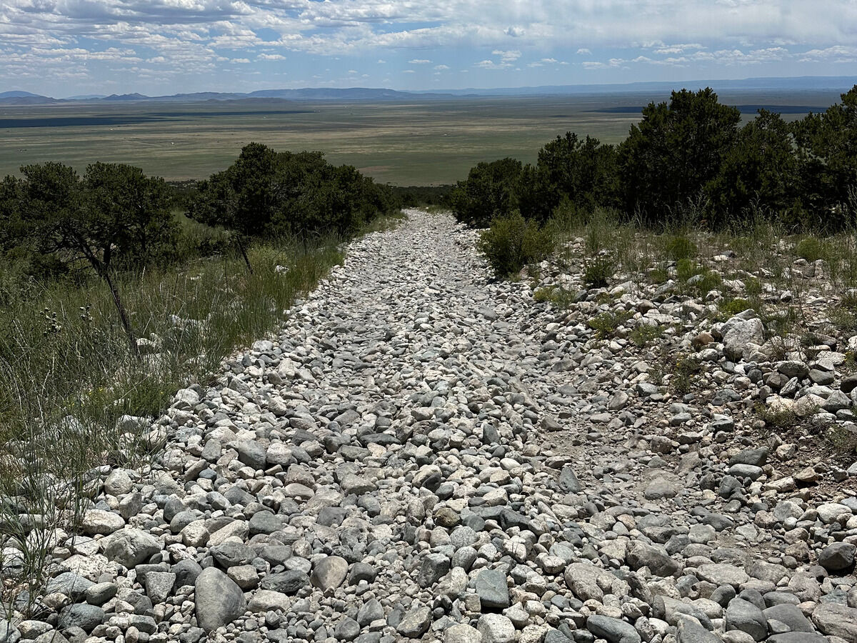
- This was probably the worst “road” I’ve attempted to drive and it’s not even close. What you see in the last picture is the “road” that quickly turns into the “road”/”trail” in the pictures before it. I think the most tricked out vehicles and ATVs can make it all the way up to Lake Como at 11700 feet, but I honestly should have parked at end of the smooth dirt road at 8000 feet and walked from there. There is no incentive to improve this road and in fact, the cruelty is probably the point since the “road” is managed by some off-road association.
- The road situation really soured my experience, but the traverse itself was fine. I would definitely stay on the ridge proper if I were to do this again instead of dropping down at points like some people recommend - too bad I’m not ever coming back lol.